Hey, there! Log in / Register

Wait, where'd the rest of the tracks go?
By adamg on Mon, 10/24/2016 - 10:37am
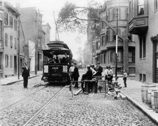
The folks at the Boston City Archives wonder if you can place this scene. See it larger.
Neighborhoods:
Topics:
Ad:
Support Universal Hub
Help keep Universal Hub going. If you like what we're up to and want to help out, please consider a (completely non-deductible) contribution.
Comments
My guess
Corner of Green Street and Chestnut St. in J.P.
Charlestown, Warren St at Cordis St.
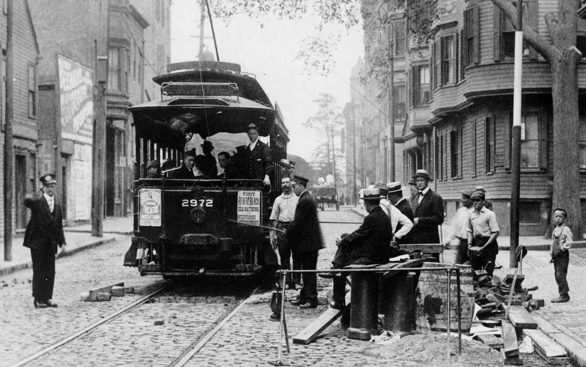
Here's what it looked like earlier this morning:
Question on the marked bike lane
Is that lane with the cars parked on the right solely for bikes?
Yes
I ride it almost daily. It is surprisingly unencumbered by idiots trying to drive or park in it.
The cars are legally parked,
if that's what you're asking.
This street is a bit narrow for the bike lane that they've jammed in there (hence the bike lane is only striped on its left side), but [people in] cars drive slowly enough that it doesn't really seem to be an issue.
As a driver, I don't know
As a driver, I don't know what to make of it. To me it looks like the whole lane is for cyclists and those cars are parked illegally.
Thanks for the clarification, although I'm still unsure as to which is which.
There are signs at the curb
indicating parking is allowed.
Wow, good work!
I was going to guess Main Street in Charlestown based on the trolley's various signs (especially the one with SULLIVAN SQUARE), but this looks like a much better answer.
Yes!
That's exactly where I thought it was.
Where did the tracks go?
Might be nice if you could at some time later let us know the location.
Pre-1930s
Say, between, 1900-1920s, probably closer to turn of the 20th century.
Wasn't the elevated Orange Line above this location
starting in 1901? If so, the photo must be from before that year.
Not quite
I believe the elevated track was actually one block over on Main St.
Yes,
....a block over on Main.
The Answer
Thanks for playing, folks! This photo shows Warren Street in Charlestown on August 19, 1914.