Hey, there! Log in / Register


French Toast Alert Level: 1 Slice / Low. Explanation.
Rain
By adamg - 8/19/21 - 1:48 pm

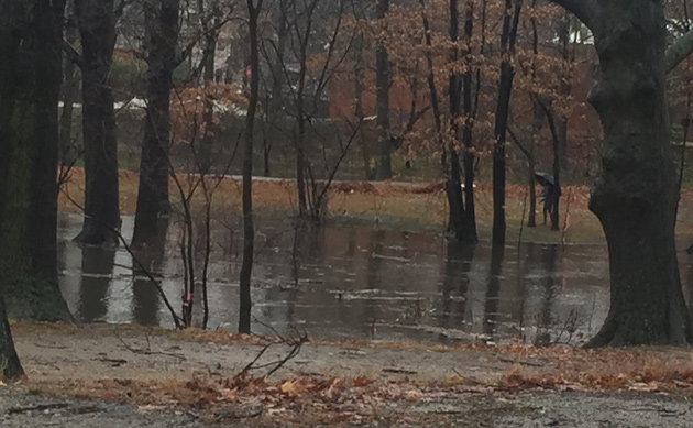
Somerville City Councilor Ben Ewen-Campen captured the scene along the Fitchburg Line tracks, next to the impending Union Square Green Line stop, after this afternoon's drenching rain. Note the floating timbers. Read more.
By adamg - 8/19/21 - 1:06 pm
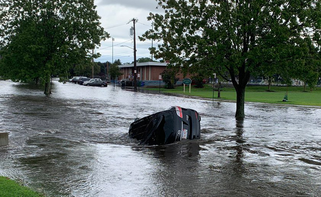
Photo by Newton FD.
The Newton Fire Department reports the normally quiet Cheesecake Brook, which runs alongside Albemarle Field, turned into a torrent in the rains this afternoon, swallowing an unoccupied car.
Separately, the National Weather Service issued a tornado warning for Revere, Lynn and surrounding areas - sparking phones across Suffolk County to ping, even phones as far south as Roslindale, where at the time, there was no rain, no wind and bright sun trying to break through the haze.
By adamg - 8/19/21 - 10:59 am
The National Weather Service has issued a flash-flood warning for greater Boston that runs through 1:45 p.m. Read more.
By adamg - 7/27/21 - 8:31 pm

T. Anderson captured the vibe during the storm at Forest Hills.
Elsewhere, Channel 7 reporters didn't have to even venture outside to get some news, lightning crashed and trees fell across the Boston area. Read more.

By adamg - 7/5/21 - 9:39 pm

The latest National Hurricane Center cone of probability for Tropical Storm Elsa shows us maybe getting hit with lots of rain and winds between 39 and 73 m.p.h. sometime Friday (the "S" means winds in that range). Of course, a lot can happen between now and then, but it's something to keep an eye on.
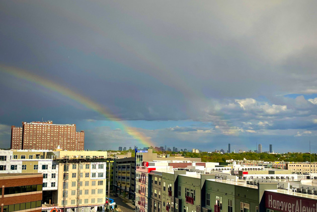
By adamg - 6/30/21 - 9:38 pm
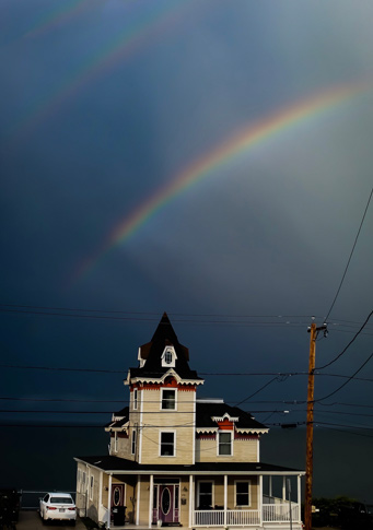
Never mind a double rainbow, Cat Queen saw a triple rainbow over the water from Revere this afternoon.
More rainbow shots: Read more.
By adamg - 5/12/21 - 9:21 pm
RoadTrip New England captured the scene this afternoon.
More views: Read more.
By adamg - 12/23/20 - 11:44 pm
The National Weather Service advises you do that because we're expected to get a mighty wind on Christmas Day, not to mention potentially record setting amounts of rain (Harvey Leonard's looking at 2 1/2 inches in Boston), which is probably not what we want to see on top of all the snow.
By adamg - 11/23/20 - 10:09 am
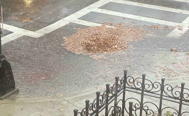
Cloggy leaves cover catch basin at Comm. Ave. and Gloucester Street in the Back Bay.
On this rain-soaked morning, Boston's 311 system is filling up with complaints this morning about flooding caused by catch basins blocked by leaves, from Spring Park Avenue in Jamaica Plain to Commonwealth Avenue in Brighton and Kittredge Street in Roslindale, from East 7th and M streets in South Boston to the aptly named Pond Street in Dorchester.
By adamg - 11/15/20 - 10:26 pm
The National Weather Service just issued a severe thunderstorm warning for much of eastern Massachusetts, including Boston, that runs through 11:15 p.m. Wind gusts up to 60 m.p.h. and hail the size of pennies possible.
By adamg - 11/10/20 - 4:12 pm
The Massachusetts Executive Office of Energy and Environmental Affairs reports that while the entire state is still kind of droughty, precipitation last month means we're no longer in a critical drought.
Ed. note: Further proof comes in the Charles River between Millennium and Cutler parks, where the islands or sandbanks that had appeared over the summer - long enough to begin to get colonized by land-based plants - are now under water again.
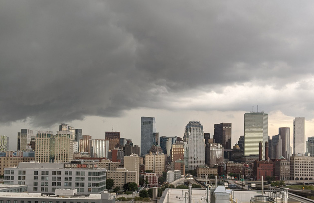
By adamg - 8/23/20 - 5:51 pm
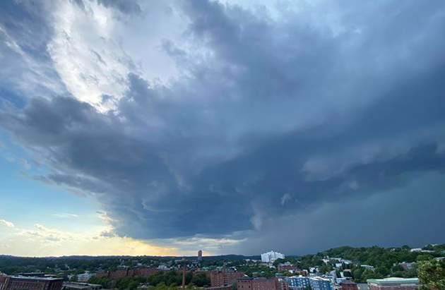
Evan Stark captured the storm moving in over Jamaica Plain, just before the skies opened up this afternoon:
Emily Murphy, meanwhile, looked out over downtown Boston around 4:45 p.m.: Read more.
By adamg - 7/10/20 - 12:18 am
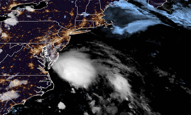
Fay at 9:50 p.m. Source.
Friday morning update: Fay's path has shifted enough that the NWS has taken down its flash-flood watch for eastern Mass.
The National Weather Service has posted a flash flood watch for the entire state for Friday afternoon through Saturday as tropical storm Fay approaches: Read more.
Support Universal Hub
Help keep Universal Hub going. If you like what we're up to and want to help out, please consider a (completely non-deductible) contribution.